


The Rakytovce cadastral area
The area at the junction of the Zvolen Basin and the Kremnica Hills — where the floodplain of the Hron meets the Mesozoic hill country.
The area between the Hron and the Kečka
The northernmost point of the cadastral area lies in the Rakytovská Valley at the junction of the cadastral boundaries of Badín, Kremnička and Rakytovce, near the Kečka quarry. On the Kečka ridge, the boundary reaches its westernmost point and turns south-east, where it reaches its highest point at an altitude of approximately 475 m.
It runs through the valley between Kečka and Krásny vršok to the edge of the woodland and descends past Kolónia Baňa into the valley of the Vlkanovský stream. Just before the football pitch fence, the boundary line leaves the stream and, running along the edge of the lay-by, crosses the fields to the locality of Čierne blato. At its lowest point, at an altitude of 318 metres above sea level, it runs parallel to the main road to the left bank of the River Hron.
The westernmost and easternmost points are 2.4 km apart as the crow flies, and the northernmost and southernmost points are 1.8 km apart. If we were to walk all the way round the Rakytovce district, it would be exactly 7 kilometres.
Geological structure and relief
Geomorphologically, the entire cadastral area lies within the Zvolen Basin — an intramountain depression in the Inner Western Carpathians. The eastern half of the cadastral area, on the banks of the Hron, forms part of the Sliač Basin sub-region, whilst the western half, which is predominantly forested and rugged, lies in the Bystrica Valley at the foot of the Kremnica Hills.
The cadastral area consists mainly of volcanic and carbonate rocks. On the Hron floodplain, where the built-up area is concentrated, the surface consists of Neogene rocks — clays, sands and gravels. The transition between the basin and the volcanic massif is formed by a mixture of volcanic and carbonate rocks.
The north-western tip of the cadastral area is formed by Mesozoic rocks — sandy limestones, radiolarites, variegated clay shales and Triassic dolomites. The Kečka limestone deposit lies here. Kečka Hill (497 m above sea level) lies on volcanic rocks — pyroxene andesites — which are among the older stratovolcanoes of central Slovakia.
"Rock formations emerge on the surface in the Rakytovská Valley, where the Rakytovský Stream carves a gorge on the right bank, with a small cliff rising above the site of the former Rakytovský mill."
The River Hron and the streams within the parish boundaries
Hydrologically, the area falls within the Hron river basin; the river flows through the cadastral area along its eastern edge for a distance of 280 m. The drainage conditions are typical of a highland-lowland area with a snow-rain regime — the highest flow occurs in March (from melting snow) and the lowest in September.
The main feature of the cadastral area is the Rakytovský stream — a right-bank tributary of the Hron, historically also known as the Báčovský jarok, Krmník or Potok Hrenocz. It rises in the Kremnické vrchy hills below Vysočina (859 m above sea level) and, after a distance of just under 7 km, flows into the Hron. It flows south-east through a predominantly wooded valley, passing the Kečka quarry, and runs through a regulated channel past the cooperative’s premises.
Other streams include Potôčok (a seasonal stream draining the centre of Rakytovce) and Vlkanovský potok, locally known as Kriedovický jarok, which flows past the hamlet of Kolónia Baňa and the football pitch.
Floods on the Hron
Floods affecting the Rakytovce area were recorded in 1784, 1813, 1853 and 1974. A maximum flow rate of 560 m³/s was recorded on 22 October 1974 at a water level of 494 cm.
The climate of Rakytovce
The district lies on the border between the warm and moderately warm climatic regions of Slovakia. The area on the Hron floodplain belongs to a warm, moderately humid climatic region with mild winters. The remainder of the district to the west falls within a moderately warm but very humid highland zone.
The nature of the weather is determined by the town’s location within an intermontane depression surrounded by the Western Carpathian mountain ranges, where temperature inversions frequently occur — foggy conditions, smog and the accumulation of cold air in the basin. On average, 80 to 100 days of fog are recorded, which is roughly a quarter of the calendar year.
Vegetation of the cadastral area
The partially deforested area outside the village consists of permanent grassland — meadows, pastures and hayfields. The remainder is covered by mixed forests comprising beech, pine, oak, spruce, birch and other forest trees. Phytogeographically, the area belongs to the Holarctic region, the Euro-Siberian subregion and the Central European province.
Beech forests are the dominant tree species in the submontane beech vegetation zone. Among the old trees within the village are three massive lime trees in the village cemetery. Outside the built-up area, a striking solitary cherry tree grows in a meadow between Krásny vršok and the cemetery — a tree of imposing stature, forming a picturesque feature of the landscape.
Trees and shrubs
- European beech (Fagus sylvatica)
- Sessile oak (Quercus petraea)
- European hornbeam (Carpinus betulus)
- Silver birch (Betula pendula)
- Scots pine (Pinus sylvestris)
- Norway spruce (Picea abies)
- Goat willow (Salix caprea)
- Common hazel (Corylus avellana)
- Dog rose (Rosa canina)
- Cornelian cherry (Cornus mas)
Herbs and mushrooms
- Cowslip (Primula veris)
- Common dandelion (Taraxacum officinale)
- Wood anemone (Anemone nemorosa)
- Common sage (Salvia officinalis)
- Peppermint (Mentha piperita)
- St John's wort (Hypericum perforatum)
- Summer cep (Boletus reticulatus)
- Chanterelle (Cantharellus cibarius)
- Aspen bolete (Leccinum albostipitatum)
- Parasol mushroom (Macrolepiota procera)
Fauna of the local area
The animal kingdom is represented by fauna characteristic of the Carpathian foothills and mountainous regions. The cadastral area comprises a mosaic of animal communities inhabiting forests, scrubland, rocky areas, meadows, pastures, fields, water bodies and gardens within the built-up area.
Mammals and reptiles
- Wild boar (Sus scrofa)
- Roe deer (Capreolus capreolus)
- Red deer (Cervus elaphus)
- Red fox (Vulpes vulpes)
- Brown bear (Ursus arctos)
- European badger (Meles meles)
- Red squirrel (Sciurus vulgaris)
- Grass snake (Natrix natrix)
- European green lizard (Lacerta viridis)
- Fire salamander (Salamandra salamandra)
Birds and insects
- Common buzzard (Buteo buteo)
- Tawny owl (Strix aluco)
- Great spotted woodpecker (Dendrocopos major)
- White stork (Ciconia ciconia)
- Barn swallow (Hirundo rustica)
- Common cuckoo (Cuculus canorus)
- Old World swallowtail (Papilio machaon)
- Clouded Apollo (Parnassius mnemosyne)
- Seven-spot ladybird (Coccinella septempunctata)
- Rose chafer (Cetonia aurata)
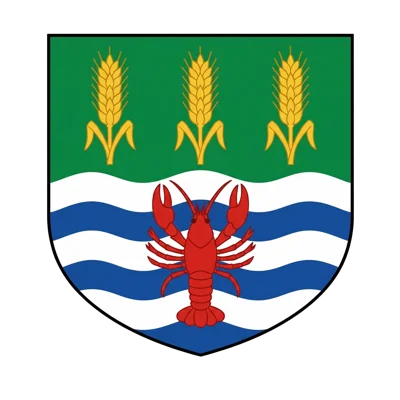
The crab in the Rakytovce coat of arms
As recently as 2015, two European crayfish (Astacus astacus) were spotted in Banský jarok, near the football pitch. The crayfish is the symbol of Rakytovce — although the actual origin of the village’s name comes from the plant ‘rakyta’ (Salix caprea), the goat willow, which still grows commonly along local streams to this day.
Place names and historical names
The territory of Rakytovec was separated from the Badín district by a royal grant in 1295. The name Rakytovec is mentioned in the titles of local noblemen from the mid-14th century. Before 1467, there was Horný Rakytovec and the smaller Dolný Rakytovec.
Historical names of the Rakytovský stream
The oldest name, Hrenocz (Chrenovec), was derived from the horseradish growing on the banks of the stream. The name Krmník comes from the term ‘krmník’ — meaning ‘cowshed’ — perhaps because of the stream’s location, as it flowed past the cowsheds.
Protected areas in the surrounding area
There are no specially protected areas within the Rakytovce cadastral area itself. However, there are several sites of conservation importance in neighbouring cadastral areas:
Find out more about Rakytovce
Detailed information about the natural environment and the municipal area can be found in the monograph *Rakytovec: A Town with Seven Streets* by M. Pecník and V. Luptáková (2015).